


The EasyWays team took care of all the logistics, including booking comfortable accommodations and arranging baggage transfers between each stop. Every hotel and guesthouse I stayed at was welcoming, clean, and perfectly located along the route. It was such a relief to know my bags would be waiting for me at the end of each day—one less thing to worry about after a full day of hiking!
What really stood out was the attention to detail and personalised service. The comprehensive information pack provided before my journey was full of useful tips, detailed maps, and a clear itinerary that made navigation a breeze. Whenever I had a question, the team was quick to respond with friendly and helpful advice.
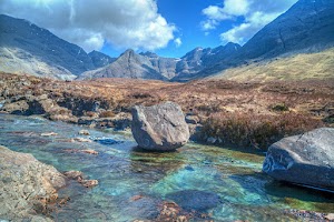
Walking the West Highland Way is a bucket-list adventure, and EasyWays made it all the more special by handling the planning so I could focus on the incredible scenery, from the dramatic peaks of Glencoe to the serene shores of Loch Lomond. This was my first walking holiday, and I’m already looking forward to booking my next trip with them.
If you’re looking for a hassle-free walking experience where everything is taken care of, I wholeheartedly recommend EasyWays. Their expertise and thoughtful planning made this one of the most memorable trips of my life!

From start to finish, everything ran so smoothly. The accommodations were lovely and we couldn't fault the selection EasyWays booked for us. We will definitely book with them again.

1. Payments are made in a way that you do not know exactly what you will get until after you pay, you get a general program and then refunds are not easyways. read the small letters!!
2. In case of no accommodation, they offer a transport with bus or taxi to a different location. in our case taxi was delayed for a very long time ended in very late arrival to the gust house.
3. In accurate place of the first luggage pickup


They arrange for your luggage to the shifted from accommodation to accommodation so all you need to do is focus in your walk. They arrange any necessary transfers. They take out all the stress of planning popular tours like the West Highland Way. However if your have special requirements they are able to tailor tours to suit your needs. They can help you arrange for dogs/young children to travel with you based on accommodation that can host these requirements. Either fill in an enquiry form via thier website or send the team an email. I am an amateur walker and Easyways showed me how much more I can do and inspired me to some phenomenal walks and see the best of Scotland.


We have been very happy with the standard of accommodation over the years.
The staff at Easyways are great to deal with - friendly and helpful and the whole process is entirely painless.
In a nutshell, we automatically turn to Easyways when considering a long walk - wouldn't go anywhere else!
Route Stops
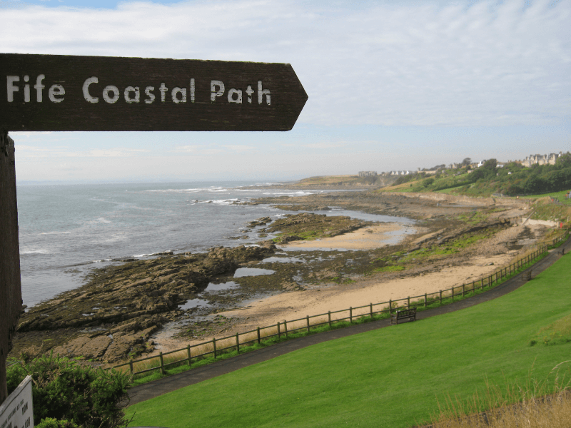
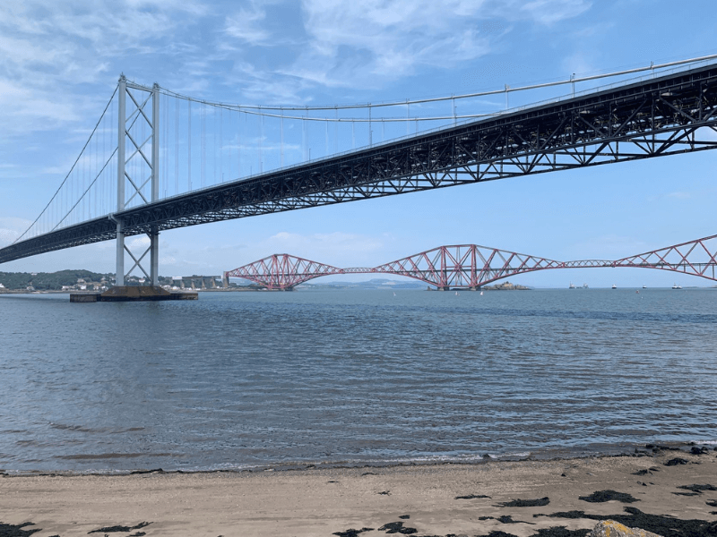
South Queensferry is your start point on the Fife Coastal Path and offers the oppertunity to walk across the iconic Forth Road Bridge, now closed to public traffic and therefore a much quieter experience.
On crossing, arrive in North Queensferry, a great location to enjoy great views of the Firth of Forth. From river level, take some time to visit the pier that is home to Queensferry Light Tower, the smallest one in the world of its kind that is still in use. Find out about its fascinating history where until 1964, the pier was the main port for ferries crossing the Forth. These days, boats set off from North Queensferry to tour the bridges, wildlife, and the islands of the Forth including the Bass Rock.
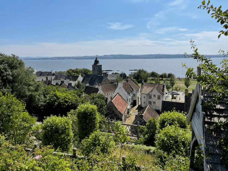
Continue through North Queensferry (named after a ferry service between Dunfermline and Edinburgh Castle that was established at the request of Queen Margaret in the 11th century) to the ancient burgh of Inverkeithing, then on past the modern estate of Dalgety Bay to Aberdour with St Finnan’s Church and the 12th Century Castle. Finish the day by walking around Aberdour’s Silver Sands and ending at Burntisland. This section offers fantastic views to Edinburgh and Inchcolm Island across the Firth of Forth.
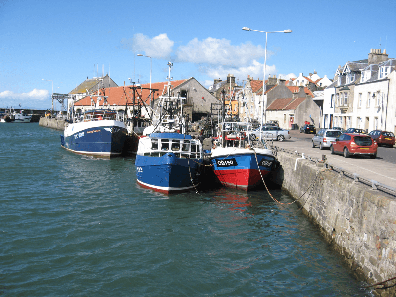
A seafront walk to begin, alongside the east coast railway line, beside the main A921 road to pass Pettycur Bay Caravan Park dominating the inland skyline before reaching Kinghorn. Follow the waymarked signs through the town to regain the beach coastline and road as before and on to Kirkcaldy. Walk along the town Esplanade and up over the steep rise to regain the coastline on past Buckhaven and Methil to reach Leven. This section includes the lovely harbour at Dysart and Macduff’s Castle, built in the 11th century at the time of King MacBeth.
A short section today from Leven to pass Lundin Links and Lower Largo (home of Alexander Selkirk, author of Robinson Crusoe) on mainly coastline and beach, walking round the curve of Largo Bay to enter Elie by first encountering the climb above the impressive basalt cliffs at Kincraig Headland and taking the path around the town golf course. Note that a part of this route is chain linked along the coast and can be inaccessible at high tide. Alternatively the old railway line can be used as an alternative inland route finder.
Depart Elie by the coastal path at Ruby Bay, to reach the Auld Kirk at the western end of St. Monans, said to be the closest church to the sea in the UK. Walk on to St. Monans harbour, with its fishing boats and continue to Pittenweem, one of the most picturesque of the East Neuk villages. Continue along the sea front reaching the golf course by the shore to reach Anstruther, the largest of the fishing villages in the area then on through the town to emerge at secluded Cellardyke harbour, with excellent views over the Forth to the Isle of May and the Bass Rock. Walk on over beach and path to soon visible Crail (made a Royal Burgh by Robert the Bruce in 1310) and it’s beautiful harbour.
The remotest part of the Path, leaving Crail to the round headland of Fife Ness, past Kingsbarns and on to St Andrews. This section is predominately coastline, traversing the most eastern part of the Kingdom of Fife, with a few inland sections through farmland and one longer stretch through woods to cross the Kenly Water. Passing Cambo Woods and on from Kingsbarns, the route is particularly enjoyable (and at times challenging as it crosses boulder strewn parts of the coast) towards St Andrews, with the Cathedral spires and University Buildings in the distance. The final few miles are alongside a golf course to enter the town past a caravan leisure park, swimming pool and the small harbour at Kinkell Braes. As before some sections are by chain path and at times impassable at high tide.
Whether you finish your walk in St Andrews or choose to continue on to Newport-on-Tay, we recommend that you take the time to explore St Andrews before leaving the “Kingdom of Fife”.
This stage of the Fife Coastal Path begins with a long stretch along the cycle route adjacent to the road from St Andrews to Guardbridge. After Leuchars the route becomes more attractive before the Tentsmuir plantations lead on to Tayport. The historic location of the Old Course with the world famous Clubhouse and Swilcan Bridge makes for a wonderful beginning to the day before reaching the hedged pathway alongside the main A91 road to Guardbridge, the lowest bridging point on the River Eden, dating from 1419. Continue on through Leuchers village past the RAF base and Earlshall Castle to follow the track into the woods and over grassy bog land by a series of boardwalks Thereafter the track heads into Tentsmuir Forest and Reserve to emerge at Tayport. Walk on past both East and West Lighthouses, with fantastic views over the River Tay to Dundee, and pass through a tunnel under the Tay Road Bridge to end at Newport-on-Tay.
Fife Coastal Path
63 miles / 101 km
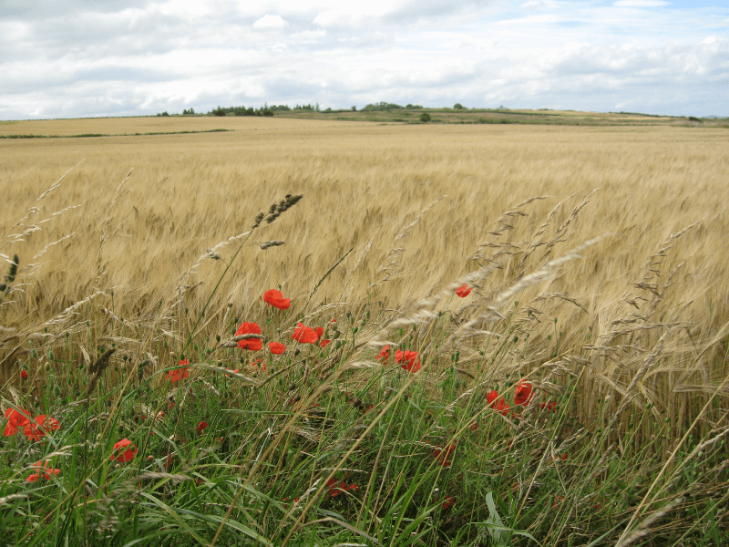
Experience dramatic cliffs and sea caves, rocky shorelines, miles of sandy beaches, and numerous small fishing villages with quaint harbours on the walk that traces the northern shoreline of the River Forth.
As the river widens to become the Firth of Forth, witness ancient castles and stunning sea views to the dominant Bass Rock and the Isle of May against a backdrop of Edinburgh and the Pentland Hills.
The area is a haven for wildlife, with many varieties of seabirds including puffins, kittiwakes, razorbills, guillemots, terns and oystercatchers.
The route begins in historic South Queensferry with a walk across the mighty Forth Bridge affording views either side to the rail bridge built in the late 1800’s and the newly constructed Queensferry Crossing road bridge.
Way-marked throughout it follows the northern shoreline to end at the historic university town of St Andrews, named after Scotland’s Patron Saint and is also known as the Home of Golf, with the world famous Old Course located to the west of the town.
EasyWays recommends an additional overnight in St Andrews in order to fully appreciate all the town has to offer.
Quality Accommodation
Door to Door Baggage Transfer (max 18kg)
Rucksack Readers Guide Book
Location Details For Each Accommodation
Travel Information from start to finish
Sugguested Equipment List
Route Packages
What’s included?
- An Electronic Tour Pack with full tour information downloaded to your mobile device
- En-suite accommodation from a selection of Hotels, Guest Houses and B&Bs.
- Breakfast included at all stages
- Bag Transfer at All Stages (max 18kg)
- An Fife Coastal Path Walking Guide Book
- A Guibo GPS Mapping App detailing all walking routes
- Travel information to the start and from the finish of the walk
- Emergency support during your walking period
What’s not included?
- Evening meals, packed lunches and drinks
- Travel insurance
- Travel to and from the walk start and end point
| Days | Location |
| 1 | South Queensferry |
| 2 | Aberdour (10 miles / 16 km) |
| 3 | Burntisland (3 miles / 5 km) |
| 4 | Kirkcaldy (6 miles / 10 km) |
| 5 | Leven (10 miles / 16 km) |
| 6 | Elie (10 miles / 16 km) |
| 7 | Anstruther (6 miles / 10 km) |
| 8 | Crail (5 miles / 8 km) |
| 9 | St Andrews (14 miles / 22 km) |
| 10 | Newport-on-Tay (18 miles / 29 km) |
What’s included?
- An Electronic Tour Pack with full tour information downloaded to your mobile device
- En-suite accommodation from a selection of Hotels, Guest Houses and B&Bs.
- Breakfast included at all stages
- Bag Transfer at All Stages (max 18kg)
- A Fife Coastal Path Walking Guide Book
- A Guibo GPS Mapping App detailing all walking routes
- Travel information to the start and from the finish of the walk
- Emergency support during your walking period
What’s not included?
- Evening meals, packed lunches and drinks
- Travel insurance
- Travel to and from the walk start and end point
First established in 1996, EasyWays has built a strong reputation with the UK and International walking community in the delivery of walking holidays throughout Scotland.
The template of every successful business is grounded in long term relationships, and EasyWays, along with our accommodation providers and baggage transfer companies work as one to ensure your walk experience is both enjoyable and memorable.
As a Scottish based company we are close at hand to the walking routes and pride ourselves in delivering a bespoke service – tell us what you would like and we will build an itinerary to match.


