


The EasyWays team took care of all the logistics, including booking comfortable accommodations and arranging baggage transfers between each stop. Every hotel and guesthouse I stayed at was welcoming, clean, and perfectly located along the route. It was such a relief to know my bags would be waiting for me at the end of each day—one less thing to worry about after a full day of hiking!
What really stood out was the attention to detail and personalised service. The comprehensive information pack provided before my journey was full of useful tips, detailed maps, and a clear itinerary that made navigation a breeze. Whenever I had a question, the team was quick to respond with friendly and helpful advice.
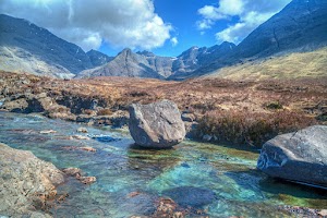
Walking the West Highland Way is a bucket-list adventure, and EasyWays made it all the more special by handling the planning so I could focus on the incredible scenery, from the dramatic peaks of Glencoe to the serene shores of Loch Lomond. This was my first walking holiday, and I’m already looking forward to booking my next trip with them.
If you’re looking for a hassle-free walking experience where everything is taken care of, I wholeheartedly recommend EasyWays. Their expertise and thoughtful planning made this one of the most memorable trips of my life!

From start to finish, everything ran so smoothly. The accommodations were lovely and we couldn't fault the selection EasyWays booked for us. We will definitely book with them again.

1. Payments are made in a way that you do not know exactly what you will get until after you pay, you get a general program and then refunds are not easyways. read the small letters!!
2. In case of no accommodation, they offer a transport with bus or taxi to a different location. in our case taxi was delayed for a very long time ended in very late arrival to the gust house.
3. In accurate place of the first luggage pickup


They arrange for your luggage to the shifted from accommodation to accommodation so all you need to do is focus in your walk. They arrange any necessary transfers. They take out all the stress of planning popular tours like the West Highland Way. However if your have special requirements they are able to tailor tours to suit your needs. They can help you arrange for dogs/young children to travel with you based on accommodation that can host these requirements. Either fill in an enquiry form via thier website or send the team an email. I am an amateur walker and Easyways showed me how much more I can do and inspired me to some phenomenal walks and see the best of Scotland.


We have been very happy with the standard of accommodation over the years.
The staff at Easyways are great to deal with - friendly and helpful and the whole process is entirely painless.
In a nutshell, we automatically turn to Easyways when considering a long walk - wouldn't go anywhere else!
Route Stops
Forres is situated 27 miles (43 kms) from Inverness and has received the “Scotland in Bloom” award on a number of occasions.
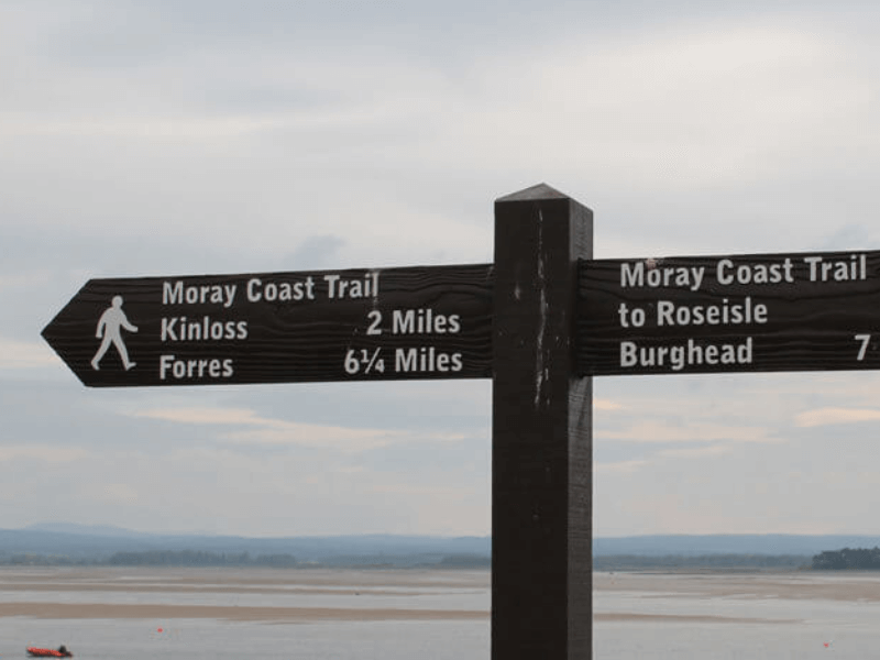
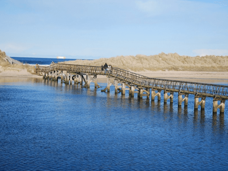
The Trail officially starts at Forres and follows the cycleway to reach the sea at Findhorn – this section could be avoided by taking a bus. The route then follows the coast along tree covered dunes to Roseisle forest, populated by red squirrels, before the stage ends at the old fishing village of Burghead. Before departing Forres ensure you visit the Suenos Stone, a mighty Pictish monument, dating back to the 9th Century that is housed in a protective glass building. Locate the cycle route to cross a bridge over the Forres and continue to Kinross along a signed path next to the RAF base fence with views along the curve of sand to Burghead in the distance.
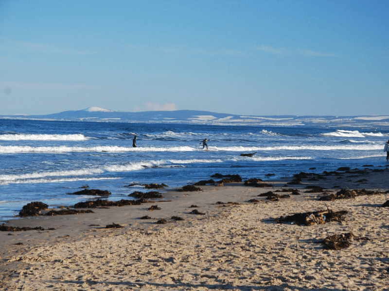
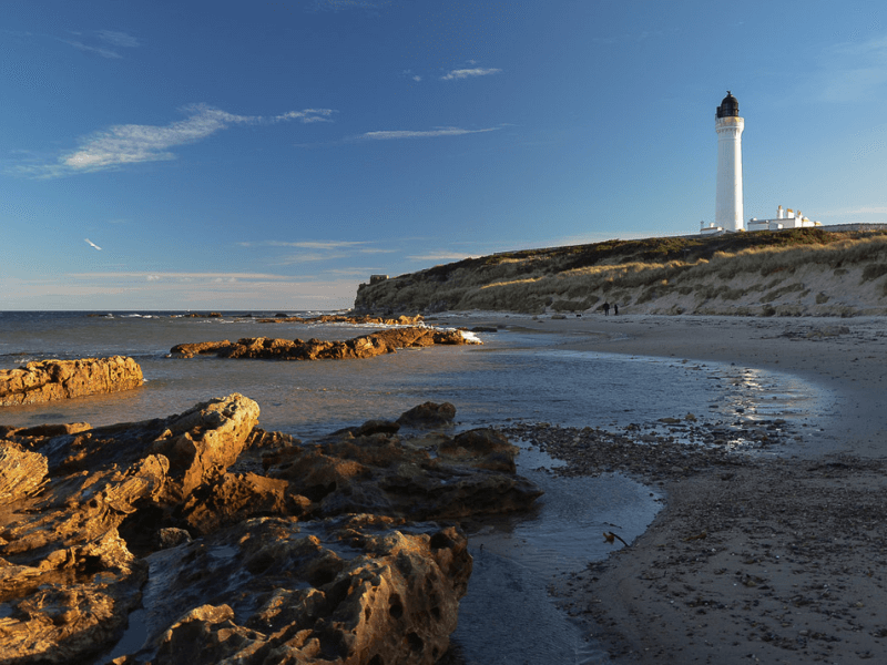
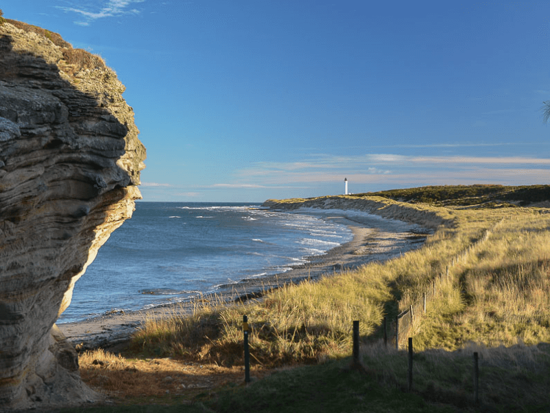
A spectacular coastal walk with fine cliff-top section, coves and sea-stacks that ends on a long walk across a huge sandy beach. Depart Burghead past the huge maltings plant owned by drinks giant on a seaside path to join the old railway which follows the coast to Cummingston. Continue along the old railway line until the outskirts of Hopeman and on past a very colourful array of traditional beach -huts across the low, grassy coast until the path climbs and then descends into Clashach Cove and a fine viewpoint above the disused Covesea Quarry and a first glimpse of Covesea Lighthouse. The path soon sweeps down onto the western end of a vast sandy beach towards the elegant Covesea Lighthouse where the beach runs uninterrupted for another two kilometres to reach Lossiemouth.
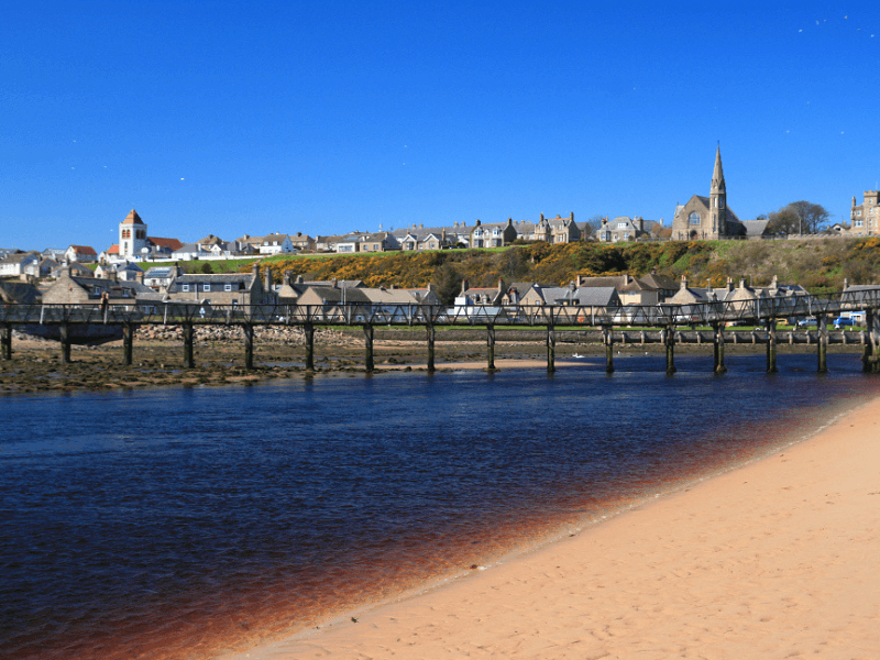
A varied section along part of the Moray Coast Trail, linking Lossiemouth via its sandy beach with Spey Bay and a chance to watch wildlife, and further on rejoins the coastline for the final stretch to the seaside town of Buckie. This long section could be broken by a stop at Spey Bay. From Lossiemouth take the bridge over the Spynie Canal to Seatown where the houses here are clustered together facing inwards to protect them from sea storms to follow the signed path for School Brae and Garmouth to cross the old railway bridge over the Spey to pass behind the the Whale and Dolphin Conservation Society Visitor Centre and continue to follow the thistle sign for the Speyside Way. Reach the coast into Portgordon passing and finally Buckpool – the old harbour of Buckie. Pass to the seaward side of several houses through the old conservation area of the Yardie to reach Cluny Square, the centre of Buckie.
The final part of the Moray Coast Trail follows the road east from Buckie but soon becomes a very fine coastal cliff-top walk linking the picturesque former fishing villages of Findochty and Portknockie. A visit to the spectacular Bow Fiddle rock follows, with a final walk along a fine sandy beach to Cullen. The A942 is the route out of overlooking the sea and pass through Portessie and Strathlene Sands to follow the grassy ground behind the sands and then rocky foreshore on to the harbour at Findochty before the path passes a cemetery with good views over the rocky coastline by Tronach Head. Keep on the main path, soon running past an amazing off-shore stack known as the Bow Fiddle eventually taking a signed branch on the left that descends steps to reach the shore, with The Whale’s Mouth – a sea-tunnel – visible over to the left before walking across the wide sands of Cullen Bay past the old fishermen’s houses of Seatown to reach Cullen and on under the old railway viaduct to reach the square at the heart of Cullen.
Congratulations – you have completed the Moray Coastal Trail! After breakfast, it is time to set off on your onward journey.
Moray Coastal Trail
42.6 miles / 68.5 km
Moray offers a stunning coastline with wide sandy beaches, dramatic cliffs, coastal formations and attractive fishing villages, making for an excellent walking route.
Beginning inland, at the fine country town of Forres, it soon reaches the coastline at Findhorn, famed for its eco-community, and thereafter crosses the forested part of the vast Burghead Bay to reach Lossiemouth.
Thereafter Spey Bay, renowned for the ship-building heritage of Buckie, is traversed before arriving at Cullen (home of the world famous Cullen Skink, a creamy, thick, smoked fish soup made with onions and potatoes).
This beautiful part of North East Scotland has much to offer and is still relatively undiscovered by walkers and outdoor enthusiasts. With its marvellous landscapes, rugged cliffs, sea caves, sheltered coves and sweeping stretches of sandy beaches, Moray has a coastline alive with wildlife that is the envy of many other similar regions in Britain.
Quality Accommodation
Door to Door Baggage Transfer (max 18kg)
Rucksack Readers Guide Book
Location Details For Each Accommodation
Travel Information from start to finish
Sugguested Equipment List
Route Packages
What’s included?
- An Electronic Tour Pack with full tour information downloaded to your mobile device
- En-suite accommodation from a selection of Hotels, Guest Houses and B&Bs.
- Breakfast included at all stages
- Bag Transfer at All Stages (max 18kg)
- A Moray Coastal Walking Guide Book
- A Guibo GPS Mapping App detailing all walking routes
- Travel information to the start and from the finish of the walk
- Emergency support during your walking period
What’s not included?
- Evening meals, packed lunches and drinks
- Travel insurance
- Travel to and from the walk start and end point
First established in 1996, EasyWays has built a strong reputation with the UK and International walking community in the delivery of walking holidays throughout Scotland.
The template of every successful business is grounded in long term relationships, and EasyWays, along with our accommodation providers and baggage transfer companies work as one to ensure your walk experience is both enjoyable and memorable.
As a Scottish based company we are close at hand to the walking routes and pride ourselves in delivering a bespoke service – tell us what you would like and we will build an itinerary to match.


